Bohemian Forest

Czechia to Austria 15/09


80k, 1 1/2 battery fulls, lots and lots of off-piste and climbing.

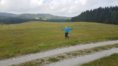
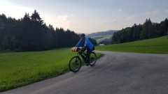
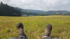
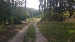
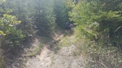
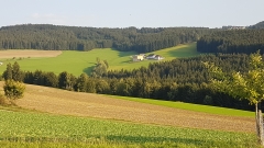
Excellent mountain biking most of the way, lots of steep muddy ups and downs, forest tracks, meadow single tracks, wrong directions aiming for the summit of Lichtenberg instead of the town, top up charging at Bad Leonfelden, booking a pension in Lichtenberg St in some other town hours away, riding down the last 10k in the dark with failing lights, discovering leberkase (Austrian fast food meatloaf – delicious) as the last place open in town.

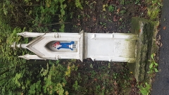
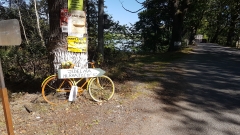
We felt like smugglers crossing the border on a remote forest tracks, and I wondered if I might be the first kiwi 68 yr old on an e-mtb to pass this way.

Total distance: 45.8 km
Max elevation: 985 m
Min elevation: 540 m
Total climbing: 915 m
Total descent: -687 m
Total time: 05:51:03
Download file: 20180915-084923.gpx
Total distance: 27.94 km
Max elevation: 926 m
Min elevation: 636 m
Total climbing: 478 m
Total descent: -603 m
Total time: 03:01:42
Download file: 20180915-163358.gpx

Tabor to Cesty Krumlow

Tabor to Trebon 12/09

50% battery use, mostly roads, not much off-piste, and fairly uppy Downy although nothing too serious.

Total distance: 70.45 km
Max elevation: 567 m
Min elevation: 445 m
Total climbing: 455 m
Total descent: -481 m
Total time: 06:20:11
Download file: 20180912-091312.gpx

Trebon to Cesty Krumlow 13/09

50% battery use again, similar riding to yesterday. I didn’t record the first 16k so 60k all up

Total distance: 43.8 km
Max elevation: 645 m
Min elevation: 304 m
Total climbing: 755 m
Total descent: -783 m
Total time: 03:51:42
Download file: 20180913-110323.gpx

Lesany to Tabor

To Tabor 11/09

75k, but 90% battery use due to a lot of climbing

Typically lovely Czeck country all day, and the help of the mapy.cz app we found ourselves on off-piste and even off-off-piste tracks which demanded mtbs. Mapy provides excellent routes for mtbs by default, so we’ve been getting off the roads far more than we could have done without it. We missed one and did a big loop around a forest because it was just an overgrown shadow down a steepish hill – awesome stuff.

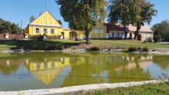
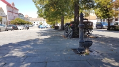
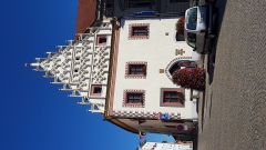
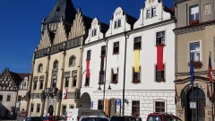
Tabor is pretty and worth an hour or two if you haven’t seen enough we’ll restored medieval towns for a while, but I really enjoyed passing through the regular tiny towns a villages on the way here. I feel like we’re seeing Czechia, more than the tidied up and sanatisef Disney version the tourists get in the main towns. We’ll skip Cesky Budweiser tomorrow for that very reason.

Total distance: 74894 m
Max elevation: 657 m
Min elevation: 365 m
Total climbing: 853 m
Total descent: -733 m
Total time: 06:26:13
Download file: 20180911-093005.gpx

Prague to Lesany

Prague to Lesany 10/09

About 10k faffing about in Prague today before I hit record, so about 65k, hilly, and about 80% battery use. It’s higher than it could be, but because the controller is so flaky, once I get it working I don’t adjust it and it’s set higher than I need a lot of the time.

The Prague shop was small but had a good guy who only spoke Czech who ran the diagnostics and worked out that there was only physical damage, but a new part would be 2 weeks away. I’ll carry on with the flaky one which works fine if I get the lead twisted exactly right and bang it a few times. Not perfect but it’s ok, and I was very glad of it today, along with the full suspension, good pedals and the freshly pumped up suspension because it wasn’t cruising by a river at all.

We started off along the EV7 but a few k down the river it became a narrow path beside a motorway, so we back tracked, found a coffee and a beer and reassessed. Luckily we hadn’t planned anything for tonight because we worked out we would have to head east about 20k to find the Greenway route which goes from Prague to Vienna, and Jill found some fantastic small tracks though forests, down to single track at times, up hills, through excessively lovely villages until at about 4 we realized that we should look for a bed. We stopped at a convenient supermarket in fgg y tdcguice (all the towns have utterly forgettably unpronounceable names) and Jill again proved her worth by finding us a bargain of a penzion in a chateau in Lesany. Part of it was originally built in 1183, but we’re in the new part, 1650 or so. The very proud owner/restorer showed us around for ages, and we met a couple of Canadians who have been doing it hard with 20k of luggage on racing bikes for the last 4 weeks, making us feel very clever.

Error When Retrieving NextGen Gallery galleries/images: $e
Total distance: 56.37 km
Max elevation: 497 m
Min elevation: 244 m
Total climbing: 646 m
Total descent: -574 m
Total time: 07:03:46
Download file: 20180910-105150.gpx
Down to Prague

Racice to Prague

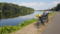
GPS recording stopped 29k from the end, so 80k today. 85-90% battery use and we’re in Prague for the weekend.


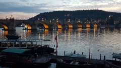
Which proved to be intensely packed with us tourists. Note to self: avoid tourist spots in weekends. Or even completely. Prague is indeed beautiful but we’re citied out and we will be skipping Vienna, making a direct path for the EV6 at Linz over the next few days. Hopefully with a new controller on Monday morning.


Total distance: 54.43 km
Max elevation: 239 m
Min elevation: 163 m
Total climbing: 356 m
Total descent: -363 m
Average speed: 19.45 km/h
Total time: 04:25:07
Download file: 20180907-082241.gpx

Sorry about all the sideways images. I’ll have to wait until I have a computer to rotate them.