Around Auckland

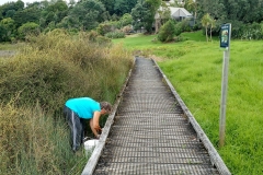
We thought we would take a look at the new Mangere Bridge, which is kind of cool with all the fixed rod holders already in place, although no bait stations, all of them being used and a very happy place it was too.

A pie from the award winning Penny Lanes up the road, carrying on up to the Southdown end of the harbour and having a great diversion chasing down a runaway dog that could do 32km/hr at least for quite a long time, taking as near as we could to the old portage route across to Panmure Basin, then along the Rotary Path to Half Moon Bay. The ferry was cancelled so they crammed us and our bikes into vans back to the city which was a bit of an adventure, and it had happened overseas we would be telling tales about it forever.

70km of city biking as good as anything anywhere in the world. Home for an outdoor bath, a lovely curry and bed.

Here’s the next experiment with Relive.

70km, 87% used – 12% Eco, 76% Tour, 12% EMTB (because I turned it on to help with a poor gear selection on a long hill, then forgot to turn it down again) EMTB mode really pushes you along!
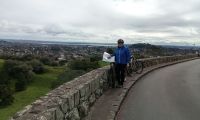
Round the harbour

10 Feb 2019

Decided to get some knives sharpened, so took them to Hobsonville Markets where the nice friendly guy did quite a good job. We carried on around to PtChev to visit a friend, then on to Susie and Steve’s to inspect the deck repairs. 


67km, battery use : about 60% used, used 2 mostly, sometimes 3, never 4, never used granny front cog

Total distance: 66843 m
Max elevation: 147 m
Min elevation: 38 m
Total climbing: 573 m
Total descent: -595 m
Download file: 23.gpx


28 Feb, 2019

Another, on my own this time. SOme battery used before I started so it’s hard to say how much used this time.

Total distance: 54499 m
Max elevation: 143 m
Min elevation: 29 m
Total climbing: 500 m
Total descent: -507 m
Download file: 25.gpx

Auckland maunga

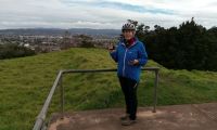
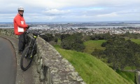
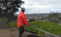
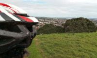
A few weeks ago we took a small trip around Panmure and Glen Innes taking in Maungarei (Mt Wellington in old imperial-speak). This one started in Westmere, across Jagger’s Bush Reserve, through Western Springs, through the Arch Hill cycle tracks, up Maungawhau (Mt Eden), Maungakiekie (One Tree Hill) and Owairaka (Mt Albert. I’m wondering why it isn’t called Maungawairaka or something like that).


Jaggers Bush is quite good, but there’s only a short rideable section and then you have to negotiate your way up and down some steps to the track beside the sports fields, so it’s probably best to leave that one for the walkers. Western Springs tracks are great for slow moving family rides but watch out for chilodren, old folks, Asian tourists photographing ducks and each other and ducks, geese and swans. Arch Hill has some interesting single track rides which we couldn’t do on the day because it had been very wet the week beforre so I’ll hop over there again some fi9ne day and give myself a workout on them.


You can get to Maugawhau mostly on side roads, and the ride up is easy enough (power level 4, but I could have used 2 with granny gear just as easily), and there’s a certain smugness to being able to get to the summit on wheels while the car-bound mob have to walk the last few hundred metres.


Getting to Maungakiekie is a bit more fraught because you have to negotiate some main roads like Gillies Ave and Manukau Rd, but once you get across to Puriri Dr you could easily spend half a day cruising around the parks, sharing with slow moving cars. The summit is a bit of 4-power stretch.


Running out of time we by-passed Puketapapa (Mt Roskill) and went straight for Owairaka. Summit Rd is no problem, and the ring road around the craters is easy and undulating, providing great 360 degree views of the whole city from a different, less touristy angle, and then it was an easy ride past the the Motat planes back to the car.


Total distance: 39.51 km
Max elevation: 199 m
Min elevation: 1 m
Total climbing: 1375 m
Total descent: -1365 m
Average speed: 17.39 km/h
Total time: 04:41:06
Download file: maunga-eden-albert.gpx

Maungakiekie

Image 1 of 5

Maungakiekie

Panmure/Glen Innes, Maungarei

One of our aims is to bike up all of the maunga around Auckland.  This one takes in the new Cycleway from Meadowbank to Glen innes – not very long but 4m wide concrete is a treat, with platforms on the slopes to slow us down. They would have worked if I didn’t have a full suspension bike 🙂

Total distance: 20.48 km
Max elevation: 140 m
Min elevation: 28 m
Total climbing: 836 m
Total descent: -825 m
Average speed: 14.38 km/h
Total time: 03:44:50
Download file: Jun_17,_2017_12_25_01_PM.gpx


Around the Harbour

From home to the boat at Hobsonville Marina,  find our way around the harbour to the NW bike link to the city, nice couple of beers and a cuppa for Jill at the bar downtown, ferry over to Northcote and home.

Error When Retrieving NextGen Gallery galleries/images: $e
Total distance: 58.72 km
Max elevation: 138 m
Min elevation: 26 m
Total climbing: 2049 m
Total descent: -2119 m
Average speed: 21.00 km/h
Total time: 07:24:53
Download file: AroundHarbour.gpx